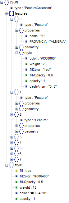
This example shows the load of a
GeoJSON CSS file that contains layer-level and feature-level styles
For generating Leaflet-compatible geographic information in this format, you can use the GeoWE GIS Web Platform. For further information, please check http://www.geowe.org. You can also access this on-line SIG on http://map.geowe.org
José María Martínez Luna (@jmmluna_sig)
http://about.me/jmmluna | https://jmmluna.github.io
jmmluna@gmail.com | jose@geowe.org